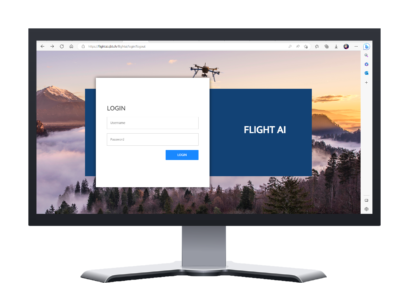
The Flight AI project aims to facilitate the compilation of the safety risk assessment document, as established for drone operations in Specific Category by EASA, by integrating into SAMWISE the Artificial Intelligence (AI) technology developed by the FET-OPEN GOAL-Robots project. In this article, you will be guided in the platform to learn the functionalities developed in the tool. Let’s take a look!

If you want to enjoy the benefits of the Flight AI tool, the first step is to create your own personal account on the platform. Then, you will be able to insert the address of the area where your drone operation starts in the left side on the display. With the zoom in and zoom out button, you can adjust the portion of the area shown in the interface.
Click on the button “Draw Polyline” and draw on the map the pursued path of your drone operation. As you can see in the video below, once you have drawn the path, you need to click on the button “Optimize” and insert the details required, including flight condition, features of the UAS employed, and potential criticalities of your mission. Now you can submit your request!
The tool will provide you with the value of the Ground Risk Class, Air Risk Class, and Sail. At this point, you can also ask the AI to furtherly optimize your UAS operation. The toll will suggest you the safest solution to carry out your operation and the best to obtain the authorization from the competent Aviation Authority.
Flight AI is the do-it-all tool you need to fly safely and with little effort.
Explore more on: FLIGHT AI: AN AI SEARCH ENGINE TO SUPPORT UAS OPERATORS (eurousc-italia.it)

This project has received funding from the European Union’s Horizon 2020 research and innovation programme under grant agreement No 101034937.


